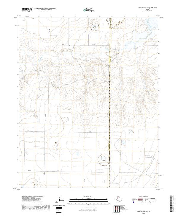
2022 Map of Buffalo Lake SW
USGS Topo · Published 2022About this map
Tierra Blanca Cr meanders across this High Plains landscape, cutting a distinct valley through the prairie of the Texas Panhandle. The map captures the quiet transition across the county line between Deaf Smith Co and Randall Co, an area defined by its vast agricultural grid. A network of rural section roads, including Co RD BB and Co RD 8, provides a clear view of land division and property access in this ranching and farming corridor. The presence of FM 1259 in the southwest corner connects these remote sections to the larger regional infrastructure. This survey is particularly useful for those tracing family land holdings or studying the modern topography of the Buffalo Lake periphery, where the terrain is shaped by the ephemeral drainage patterns of the Llano Estacado.
Find a feature on this map
11 named features on this map. Tap any name to fly to it.
Don’t see what you’re looking for? This feature index may not catch every label — zoom into the map to look around manually.
Map Details
Editions of this 2022 Buffalo Lake SW Map
This is the sole edition of this map. No revisions or reprints were ever made.
Other maps of this area

1954 · Clovis
USGS Topo · 1:250,000

1958 · Clovis
USGS Topo · 1:250,000

1961 · Buffalo Lake
USGS Topo · 1:62,500

1966 · Jumbo
USGS Topo · 1:24,000

1966 · Nazareth NW
USGS Topo · 1:24,000

1966 · Arney
USGS Topo · 1:24,000

1971 · Hereford NE
USGS Topo · 1:24,000

1971 · Hereford SE
USGS Topo · 1:24,000
1984 · Dawn
USGS Topo · 1:24,000
1984 · Umbarger
USGS Topo · 1:24,000