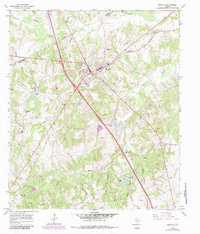
1965 Map of Buffalo
USGS Topo · Published 1983About this map
The town of Buffalo serves as a critical junction in Leon County, where the Missouri Pacific Railroad intersects with major regional thoroughfares. This 1965 survey, updated with 1982 revisions, reveals a landscape defined by small-scale community landmarks and extensive water networks. Local family and church history is well-represented by sites such as Cedar Creek Ch and Davis Chapel, along with several outlying burial grounds like Sand Hill Cem and Nettles Cem.
Find a feature on this map
35 named features on this map. Tap any name to fly to it.
Don’t see what you’re looking for? This feature index may not catch every label — zoom into the map to look around manually.
Map Details
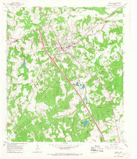
Editions of this 1965 Buffalo Map
2 editions found
Other maps of this area

1919 · Fairfield
USGS Topo · 1:62,500

1953 · Palestine
USGS Topo · 1:250,000

1954 · Waco
USGS Topo · 1:250,000

1955 · Waco
USGS Topo · 1:250,000

1956 · Jewett
USGS Topo · 1:62,500

1957 · Palestine
USGS Topo · 1:250,000

1964 · Centerville
USGS Topo · 1:24,000

1964 · Flo
USGS Topo · 1:24,000

1964 · Keechi
USGS Topo · 1:24,000

1965 · Jewett
USGS Topo · 1:24,000