
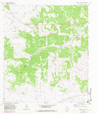
1963 Map of Buffalo Well NW
USGS Topo · Published 1966About this map
The Schleicher Co Sutton Co border bisects this 1963 survey of the Edwards Plateau, where the rugged terrain is carved by the deep drainage of Middle Valley and its Prong. This landscape is defined by its widely dispersed ranching estates, documenting the family-held lands of the mid-20th century. Named landmarks such as the Mcintosh Ranch and Copeland Ranch in the northwest, and the Schwiening Ranch further south, indicate a region dominated by livestock and large-scale land management.
Find a feature on this map
20 named features on this map. Tap any name to fly to it.
Don’t see what you’re looking for? This feature index may not catch every label — zoom into the map to look around manually.
Map Details
Editions of this 1963 Buffalo Well NW Map
2 editions found
Other maps of this area

1893 · Fort McKavett
USGS Topo · 1:125,000

1954 · Sonora
USGS Topo · 1:250,000

1958 · Sonora
USGS Topo · 1:250,000

1963 · Buffalo Well
USGS Topo · 1:24,000

1963 · Buffalo Well SE
USGS Topo · 1:24,000

1963 · Adams SE
USGS Topo · 1:24,000

1963 · Buffalo Well SW
USGS Topo · 1:24,000

1963 · Adams SW
USGS Topo · 1:24,000

1964 · Sonora SE
USGS Topo · 1:24,000

1964 · Sonora NE
USGS Topo · 1:24,000