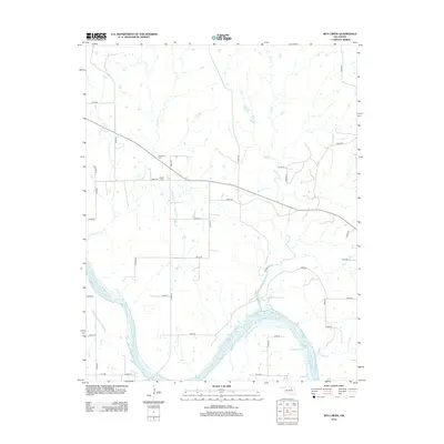
2012 Map of Bug Creek
USGS Topo · Published 2012About this map
The Arkansas River carves a braided path through the southern reaches of this landscape in Pawnee County, where low-lying islands and shifting sandbars define the waterway's course. North of the river, a network of rural roads such as Co RD-5380 and e0400 RD provides access to the agricultural uplands drained by Sycamore Cr and Bug Cr. Genealogists and local historians will find several notable landmarks preserved in this early 21st-century record, including Whitehorn Cem and Morrel Cem positioned north of the creek systems. The survey also captures a dense grid of section roads and smaller paths like Lease RD, which hint at the industrial footprint of local resource extraction and land management that has shaped this portion of Oklahoma.
Find a feature on this map
30 named features on this map. Tap any name to fly to it.
Don’t see what you’re looking for? This feature index may not catch every label — zoom into the map to look around manually.
Map Details
Editions of this 2012 Bug Creek Map
This is the sole edition of this map. No revisions or reprints were ever made.
Other maps of this area

1909 · Pawhuska
USGS Topo · 1:125,000

1910 · Pawhuska
USGS Topo · 1:125,000

1912 · Hominy
USGS Topo · 1:125,000

1915 · Hominy
USGS Topo · 1:125,000

1915 · Hominy
USGS Topo · 1:62,500

1929 · Skedee
USGS Topo · 1:62,500

1931 · Skedee
USGS Topo · 1:62,500

1932 · Fairfax
USGS Topo · 1:62,500

1955 · Enid
USGS Topo · 1:250,000

1958 · Enid
USGS Topo · 1:250,000