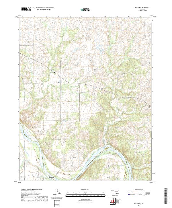
2022 Map of Bug Creek
USGS Topo · Published 2022About this map
The Arkansas River serves as the prominent natural boundary between Osage and Pawnee counties, carving a wide arc across the southern landscape. The settlement of Blackburn sits just north of the river, where local travel was facilitated by routes like the Blackburn-Skedee Rd. The surrounding terrain is defined by the drainage of Sycamore Cr and Bug Cr, which feed into several numbered reservoirs including 113109 Reservoir and 113107 Reservoir. For those tracing local family lineages, the presence of the Whitehorn Cem and the Morrel Family Cem offers specific locations for genealogical research. The map reflects a landscape of rural sections and oil-and-gas infrastructure, as indicated by Lease Rd and numerous unnamed access points, illustrating the modern industrial use of this traditional prairie and river territory.
Find a feature on this map
39 named features on this map. Tap any name to fly to it.
Don’t see what you’re looking for? This feature index may not catch every label — zoom into the map to look around manually.
Map Details
Editions of this 2022 Bug Creek Map
This is the sole edition of this map. No revisions or reprints were ever made.
Other maps of this area

1909 · Pawhuska
USGS Topo · 1:125,000

1910 · Pawhuska
USGS Topo · 1:125,000

1912 · Hominy
USGS Topo · 1:125,000

1915 · Hominy
USGS Topo · 1:125,000

1915 · Hominy
USGS Topo · 1:62,500

1929 · Skedee
USGS Topo · 1:62,500

1931 · Skedee
USGS Topo · 1:62,500

1932 · Fairfax
USGS Topo · 1:62,500

1955 · Enid
USGS Topo · 1:250,000

1958 · Enid
USGS Topo · 1:250,000