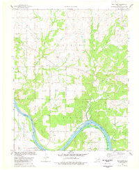
1978 Map of Bug Creek
USGS Topo · Published 1978About this map
The Arkansas River serves as the primary geographic marker here, delineating the boundary between Osage Co and Pawnee Co. This late-1970s landscape is heavily defined by the petroleum industry, with numerous oil wells and gas wells scattered across the Oil Field sections of Hominy and Fairfax. The survey captures the intricate network of service roads and pipelines that supported these extraction efforts, contrasting with the natural drainage of Bug Creek and Sycamore Creek.
Find a feature on this map
18 named features on this map. Tap any name to fly to it.
Don’t see what you’re looking for? This feature index may not catch every label — zoom into the map to look around manually.
Map Details
Editions of this 1978 Bug Creek Map
This is the sole edition of this map. No revisions or reprints were ever made.
Other maps of this area

1909 · Pawhuska
USGS Topo · 1:125,000

1910 · Pawhuska
USGS Topo · 1:125,000

1912 · Hominy
USGS Topo · 1:125,000

1915 · Hominy
USGS Topo · 1:125,000

1915 · Hominy
USGS Topo · 1:62,500

1929 · Skedee
USGS Topo · 1:62,500

1931 · Skedee
USGS Topo · 1:62,500

1932 · Fairfax
USGS Topo · 1:62,500

1955 · Enid
USGS Topo · 1:250,000

1958 · Enid
USGS Topo · 1:250,000