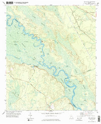
1978 Map of Bug Island
USGS Topo · Published 1978About this map
The Altamaha River winds through a complex system of islands and backwater sloughs along the borders of Long, Wayne, and McIntosh counties. This 1978 survey highlights the intricate hydrology of the region, where the river creates distinct landforms like Boyles Island, Buck Island, and Dicks Island. Small settlements such as Paradise Park and Joyner sit near the water's edge, while the inland reaches are marked by landmarks like Union Ch near Gard Road.
Find a feature on this map
65 named features on this map. Tap any name to fly to it.
Don’t see what you’re looking for? This feature index may not catch every label — zoom into the map to look around manually.
Map Details
Editions of this 1978 Bug Island Map
2 editions found
Other maps of this area

1918 · Jesup
USGS Topo · 1:62,500

1918 · Hortense
USGS Topo · 1:62,500

1918 · Everett City
USGS Topo · 1:62,500

1920 · Everett City
USGS Topo · 1:62,500

1943 · Ludowici
USGS Topo · 1:62,500

1943 · Jesup
USGS Topo · 1:62,500

1944 · Everett City
USGS Topo · 1:62,500

1944 · Hortense
USGS Topo · 1:62,500

1946 · Brunswick
USGS Topo · 1:250,000

1948 · Brunswick
USGS Topo · 1:250,000