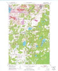
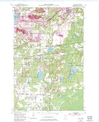
1951 Map of Buhl
USGS Topo · Published 1977About this map
Industrial iron ore extraction and specialized transportation networks define this portion of the Mesabi Range in the mid-20th century. Extensive open-pit operations including the Grant Mine, Sherman Mine, and Fraser Mine dominate the northern landscape, characterized by sprawling Mine Dump terrain and numerous Tailings Ponds. The settlements of Chisholm and Buhl serve as the primary hubs, connected by the rails of the Burlington Northern and the Duluth Missabe And Iron Range.
Find a feature on this map
46 named features on this map. Tap any name to fly to it.
Don’t see what you’re looking for? This feature index may not catch every label — zoom into the map to look around manually.
Map Details
Editions of this 1951 Buhl Map
6 editions found
Other maps of this area

1951 · Kinney
USGS Topo · 1:24,000

1951 · Kirk
USGS Topo · 1:24,000

1951 · Hibbing
USGS Topo · 1:24,000

1951 · Casco
USGS Topo · 1:24,000

1951 · Buhl
USGS Topo · 1:24,000

1952 · Riley
USGS Topo · 1:24,000

1952 · Little Swan
USGS Topo · 1:24,000

1954 · Hibbing
USGS Topo · 1:250,000

1955 · Dewey Lake SE
USGS Topo · 1:24,000

1955 · Dewey Lake
USGS Topo · 1:24,000