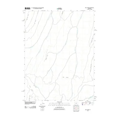
2010 Map of Bull Fork
USGS Topo · Published 2010About this map
The Roan Plateau dominates this high-altitude landscape in Garfield County, defined by a complex network of deep drainages and ridges. In this 2010 survey, the terrain is shaped by the headwaters of numerous watercourses, including Bull Fork and the intricate West Fork Parachute Creek system. The map reveals how local transportation adheres to the topography, with County Rd 87 and County Rd 89 skirting the western edges of the plateau. Notable landforms like Puddin Ridge separate the various gulches, such as Little Dry Gulch and Whiskey Gulch. This environment remains primarily focused on its natural drainage patterns, with East Willow Creek and West Hunter Creek carving significant paths through the plateau. The placement of these water sources and named gulches like Scandard Gulch provides essential geographic markers for land management and environmental study in this part of Colorado.
Find a feature on this map
24 named features on this map. Tap any name to fly to it.
Don’t see what you’re looking for? This feature index may not catch every label — zoom into the map to look around manually.
Map Details
Editions of this 2010 Bull Fork Map
This is the sole edition of this map. No revisions or reprints were ever made.
Other maps of this area

1925 · Parachute Creek
USGS Topo · 1:62,500

1927 · Parachute Creek
USGS Topo · 1:62,500

1929 · Highmore
USGS Topo · 1:62,500

1952 · Yankee Gulch
USGS Topo · 1:24,000

1952 · Rock School
USGS Topo · 1:24,000

1952 · Jessup Gulch
USGS Topo · 1:24,000

1956 · Grand Junction
USGS Topo · 1:250,000

1959 · Grand Junction
USGS Topo · 1:250,000

1960 · Grand Junction
USGS Topo · 1:250,000

1962 · Grand Junction
USGS Topo · 1:250,000