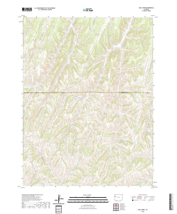
2022 Map of Bull Fork
USGS Topo · Published 2022About this map
The Rio Blanco and Garfield county line bisects this high-elevation drainage system where the landscape is defined by a dense network of gulches and creeks. Bull Fork serves as a central artery for the region, joined by numerous named tributaries including Whiskey Gulch and Enoch Gulch. To the south, the terrain descends toward the headwaters of the W Fork Parachute Cr and the Wet Fork W Fork Parachute Cr. The presence of Puddin Ridge and Sheep Gulch in the southwest corner suggests the complex topographic relief typical of the western Colorado plateau. Transportation is limited to a few corridor routes such as C R 87 and Co RD 69, which follow the natural contours of the northern draws. This map provides a detailed view of the watershed divide before the waters flow south toward the Parachute Creek valley.
Find a feature on this map
27 named features on this map. Tap any name to fly to it.
Don’t see what you’re looking for? This feature index may not catch every label — zoom into the map to look around manually.
Map Details
Editions of this 2022 Bull Fork Map
This is the sole edition of this map. No revisions or reprints were ever made.
Other maps of this area

1925 · Parachute Creek
USGS Topo · 1:62,500

1927 · Parachute Creek
USGS Topo · 1:62,500

1929 · Highmore
USGS Topo · 1:62,500

1952 · Yankee Gulch
USGS Topo · 1:24,000

1952 · Rock School
USGS Topo · 1:24,000

1952 · Jessup Gulch
USGS Topo · 1:24,000

1956 · Grand Junction
USGS Topo · 1:250,000

1959 · Grand Junction
USGS Topo · 1:250,000

1960 · Grand Junction
USGS Topo · 1:250,000

1962 · Grand Junction
USGS Topo · 1:250,000