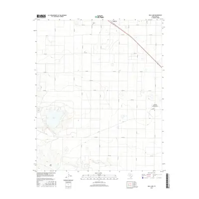
2016 Map of Bull Lake
USGS Topo · Published 2016About this map
Amherst sits at the northern edge of this Lamb County landscape, anchored by the diagonal corridor of Highway 84. The terrain is defined by the significant depression of Bull Lake, which dominates the western section of the quadrangle alongside Bull Draw and Bull Tank. This area of the Llano Estacado shows a strictly organized grid of county roads and Farm to Market routes, such as FM 54 and FM 3216, which partition the agricultural land between rare local landmarks. Genealogists and local historians can locate Fairlawn Cem near the northern townsite and Sacred Heart Cem further south. The presence of the Littlefield Taylor Brown Municipal Airport in the east indicates the modern infrastructure supporting this rural West Texas community.
Find a feature on this map
30 named features on this map. Tap any name to fly to it.
Don’t see what you’re looking for? This feature index may not catch every label — zoom into the map to look around manually.
Map Details
Editions of this 2016 Bull Lake Map
This is the sole edition of this map. No revisions or reprints were ever made.
Other maps of this area

1954 · Clovis
USGS Topo · 1:250,000

1954 · Brownfield
USGS Topo · 1:250,000

1958 · Brownfield
USGS Topo · 1:250,000

1958 · Clovis
USGS Topo · 1:250,000

1962 · Brownfield
USGS Topo · 1:250,000

1962 · Amherst
USGS Topo · 1:24,000

1962 · Sudan
USGS Topo · 1:24,000

1962 · Cofferville
USGS Topo · 1:24,000

1964 · Oklahoma Flat
USGS Topo · 1:24,000

1964 · Littlefield
USGS Topo · 1:24,000