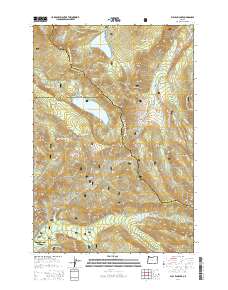
2014 Map of Bull Run Lake
USGS Topo · Published 2014About this map
Lost Lake Resort sits at the northern edge of this high-elevation landscape, where the waters of Lost Lake are framed by the peaks of the Mount Hood National Forest. This 2014 survey documents a critical watershed and recreational corridor where the borders of Multnomah, Clackamas, and Hood River counties converge. The rugged topography is defined by significant ridges like Butcher Knife Ridge and Yocum Ridge, while the Pacific Crest National Scenic Trail winds north-to-south across the terrain, passing through Lolo Pass. To the south, the settlement of Mount Hood Village anchors the Sandy River valley near Old Maid Flat. The map provides a detailed view of the drainage systems feeding the Bull Run River and Bull Run Lake, essential components of the regional water supply, alongside natural landmarks such as Ramona Falls and Salvation Spring.
Find a feature on this map
63 named features on this map. Tap any name to fly to it.
Don’t see what you’re looking for? This feature index may not catch every label — zoom into the map to look around manually.
Map Details
Editions of this 2014 Bull Run Lake Map
This is the sole edition of this map. No revisions or reprints were ever made.
Other maps of this area

1924 · Mount Hood
USGS Topo · 1:125,000

1926 · Hood River
USGS Topo · 1:125,000

1927 · Mount Hood
USGS Topo · 1:125,000

1929 · Hood River
USGS Topo · 1:125,000

1953 · The Dalles
USGS Topo · 1:250,000

1956 · The Dalles
USGS Topo · 1:250,000

1957 · The Dalles
USGS Topo · 1:250,000

1957 · Bonneville Dam
USGS Topo · 1:62,500

1957 · Hood River
USGS Topo · 1:62,500
1962 · Hickman Butte
USGS Topo · 1:24,000