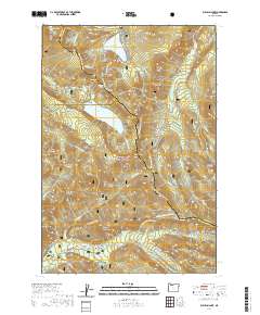
2020 Map of Bull Run Lake
USGS Topo · Published 2020About this map
Mount Hood National Forest anchors this high-elevation landscape where the boundaries of Multnomah, Hood River, and Clackamas counties converge. The glacial hydrology of the region is defined by the Bull Run Lake, which feeds the Bull Run River, and the northern slopes where the Sandy Wild and Scenic River flows near Old Maid Flat. A prominent stretch of the Pacific Crest National Scenic Trail traverses the terrain, crossing through Lolo Pass and passing notable landmarks like Ramona Falls and Sentinel Peak. The map highlights a series of distinctive ridges and peaks, including Butcher Knife Ridge and Cathedral Ridge, illustrating the complex drainage patterns that feed into the W Fork Hood River. Remote springs like Salvation Spring and seasonal passages such as Lolo Pass Road (Snow) reflect the area's use as a critical wilderness corridor and water source.
Find a feature on this map
70 named features on this map. Tap any name to fly to it.
Don’t see what you’re looking for? This feature index may not catch every label — zoom into the map to look around manually.
Map Details
Editions of this 2020 Bull Run Lake Map
This is the sole edition of this map. No revisions or reprints were ever made.
Other maps of this area

1924 · Mount Hood
USGS Topo · 1:125,000

1926 · Hood River
USGS Topo · 1:125,000

1927 · Mount Hood
USGS Topo · 1:125,000

1929 · Hood River
USGS Topo · 1:125,000

1953 · The Dalles
USGS Topo · 1:250,000

1956 · The Dalles
USGS Topo · 1:250,000

1957 · The Dalles
USGS Topo · 1:250,000

1957 · Bonneville Dam
USGS Topo · 1:62,500

1957 · Hood River
USGS Topo · 1:62,500
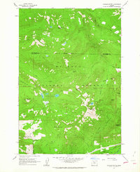
1962 · Hickman Butte
USGS Topo · 1:24,000