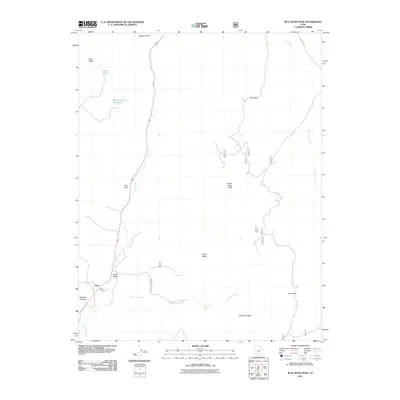
2011 Map of Bull Rush Peak
USGS Topo · Published 2011About this map
The Sevier River valley and the small settlement of Spry anchor this landscape in Garfield County. Much of the human history here is concentrated along the river corridor, where the Spry Cemetery serves as a significant landmark for those tracing local lineage. The topography transitions quickly from the river bottom into high-elevation features like Horse Valley Peak and the prominent Bull Rush Peak, which rises above the drainage of Bull Rush Creek. Water management in this high-desert environment is evident through features such as Bucket Hollow Reservoir and Marks Pond, reflecting the essential relationship between the land and its limited water resources. Further east, the terrain becomes more complex, marked by Hell Hole and the high flats of Horse Valley, accessed by remote routes like Lost Creek Rd.
Find a feature on this map
21 named features on this map. Tap any name to fly to it.
Don’t see what you’re looking for? This feature index may not catch every label — zoom into the map to look around manually.
Map Details
Editions of this 2011 Bull Rush Peak Map
This is the sole edition of this map. No revisions or reprints were ever made.
Other maps of this area

1885 · Beaver
USGS Topo · 1:250,000

1886 · Kanab
USGS Topo · 1:250,000

1953 · Richfield
USGS Topo · 1:250,000

1953 · Cedar City
USGS Topo · 1:250,000

1958 · Richfield
USGS Topo · 1:250,000

1958 · Cedar City
USGS Topo · 1:250,000

1962 · Cedar City
USGS Topo · 1:250,000

1966 · Bull Rush Peak
USGS Topo · 1:24,000

1966 · Circleville
USGS Topo · 1:24,000

1966 · Fremont Pass
USGS Topo · 1:24,000