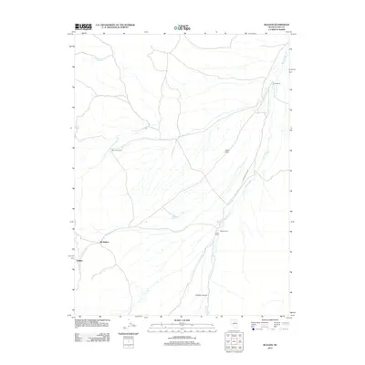
2012 Map of Bullion
USGS Topo · Published 2012About this map
Bullion and Old Bullion anchor the western edge of this Elko County landscape, tracing the remains of a mining district that once thrived in the foothills. The terrain transitions from these former mining sites into the broad expanse of Dixie Flats, where a network of seasonal watercourses and springs sustains a handful of remote ranching outposts. Water is the defining resource here, with Emigrant Spring in the north and Potato Patch Spring toward the center marking vital stops in an arid environment. The eastern portion of the sheet is dominated by the winding path of Dixie Creek, which flows past family-named landmarks including Scott Ranch, Upper Scott Ranch, and the Elliot Ranch. These features, alongside deep incisions like Crane Springs Cyn and Cissillini Canyon, illustrate the traditional high-desert land use patterns of northeastern Nevada in the early 21st century.
Find a feature on this map
12 named features on this map. Tap any name to fly to it.
Don’t see what you’re looking for? This feature index may not catch every label — zoom into the map to look around manually.
Map Details
Editions of this 2012 Bullion Map
This is the sole edition of this map. No revisions or reprints were ever made.
Other maps of this area

1934 · Jiggs
USGS Topo · 1:125,000

1937 · Jiggs
USGS Topo · 1:125,000

1952 · Dixie Flats
USGS Topo · 1:62,500

1952 · Pine Valley
USGS Topo · 1:62,500

1952 · Carlin
USGS Topo · 1:62,500

1955 · Winnemucca
USGS Topo · 1:250,000

1955 · Elko
USGS Topo · 1:250,000

1956 · Robinson Mtn
USGS Topo · 1:62,500

1958 · Winnemucca
USGS Topo · 1:250,000

1958 · Elko
USGS Topo · 1:250,000