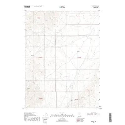
2018 Map of Bullion
USGS Topo · Published 2018About this map
The Piñon Range dominates the western landscape of this Elko County quadrangle, where the settlement of Bullion sits nestled against the high slopes. This area reflects the characteristic high-desert geography of northeastern Nevada, defined by steep ridges and the broad, lower-elevation expanse of Dixie Flats. Water sources like Emigrant Spring and Potato Patch Spring are critical markers on the land, suggesting the historical reliance on reliable springs for travelers and ranching operations in this arid environment. The eastern portion of the map transitions into the Dixie Hills, with the drainage of Dixie Cr cutting through the terrain. Further south, the deep impression of Cissillini Canyon breaks the mountain front, providing a detailed look at the complex topography and drainage patterns that have historically shaped local land use and transit.
Find a feature on this map
15 named features on this map. Tap any name to fly to it.
Don’t see what you’re looking for? This feature index may not catch every label — zoom into the map to look around manually.
Map Details
Editions of this 2018 Bullion Map
This is the sole edition of this map. No revisions or reprints were ever made.
Other maps of this area

1934 · Jiggs
USGS Topo · 1:125,000

1937 · Jiggs
USGS Topo · 1:125,000

1952 · Dixie Flats
USGS Topo · 1:62,500

1952 · Pine Valley
USGS Topo · 1:62,500

1952 · Carlin
USGS Topo · 1:62,500

1955 · Winnemucca
USGS Topo · 1:250,000

1955 · Elko
USGS Topo · 1:250,000

1956 · Robinson Mtn
USGS Topo · 1:62,500

1958 · Winnemucca
USGS Topo · 1:250,000

1958 · Elko
USGS Topo · 1:250,000