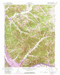
1957 Map of Bumpus Mills
USGS Topo · Published 1980About this map
Bumpus Mills and the surrounding Stewart County hills were caught in a moment of transition during the 1950s, a period marked by the damming of the Cumberland River to form Lake Barkley. This survey preserves the rural character of the landscape just as large-scale water management began to redefine the river valley, showing the Barkley Management Area and the Cross Creeks National Wildlife Refuge along the rising waters.
Find a feature on this map
40 named features on this map. Tap any name to fly to it.
Don’t see what you’re looking for? This feature index may not catch every label — zoom into the map to look around manually.
Map Details
Editions of this 1957 Bumpus Mills Map
3 editions found
Other maps of this area

1931 · Erin
USGS Topo · 1:62,500

1936 · Tharpe
USGS Topo · 1:24,000

1936 · Standing Rock
USGS Topo · 1:24,000

1936 · Dover
USGS Topo · 1:24,000

1950 · Standing Rock
USGS Topo · 1:24,000

1950 · Dover
USGS Topo · 1:24,000

1951 · Model
USGS Topo · 1:24,000

1951 · Roaring Spring
USGS Topo · 1:24,000

1951 · Johnson Hollow
USGS Topo · 1:24,000
1951 · Tharpe
USGS Topo · 1:24,000