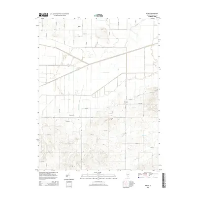
2015 Map of Bungay
USGS Topo · Published 2015About this map
Blairsville and Bungay anchor this section of Southern Illinois, where a grid of rural routes like Aden RD and CR-10 connects small communities across a landscape defined by its intricate drainage network. The area is heavily marked by the tributaries of the Little Wabash River, including the meandering Big Cr and Haw Cr, which cut through the agricultural fields and woodlots of Hamilton County. Local history and genealogy are centered around the Springer Cem, a key landmark for researchers tracing family ties to this region. The map reveals the rural infrastructure at a moment of modern continuity, showing how established settlements like Aden maintain their footprint amidst the persistent flow of Ferguson Cr and Wolf Cr. The intersection of drainage features like Wolf Cr Drain and Raders Br illustrates the managed nature of the hydrology, essential for the area's agricultural productivity.
Find a feature on this map
50 named features on this map. Tap any name to fly to it.
Don’t see what you’re looking for? This feature index may not catch every label — zoom into the map to look around manually.
Map Details
Editions of this 2015 Bungay Map
This is the sole edition of this map. No revisions or reprints were ever made.
Other maps of this area

1941 · Enfield
USGS Topo · 1:62,500

1942 · McLeansboro
USGS Topo · 1:62,500

1944 · Enfield
USGS Topo · 1:62,500

1945 · McLeansboro
USGS Topo · 1:62,500

1947 · Wayne City
USGS Topo · 1:62,500

1948 · Fairfield
USGS Topo · 1:62,500

1958 · Belleville
USGS Topo · 1:250,000

1962 · Belleville
USGS Topo · 1:250,000
1971 · Boyleston
USGS Topo · 1:24,000
1971 · Burnt Prairie
USGS Topo · 1:24,000