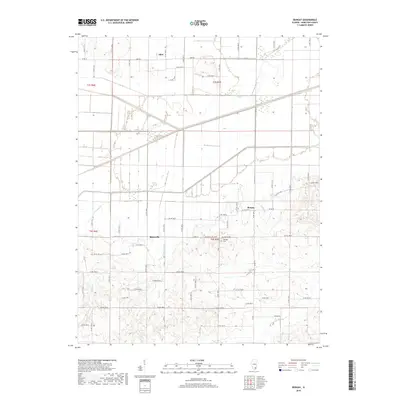
2018 Map of Bungay
USGS Topo · Published 2018About this map
Blairsville and the small unincorporated community of Aden anchor this agricultural landscape in Hamilton County. The terrain is defined by a dense network of watercourses, including the meandering paths of Haw Cr and Big Cr, which influence the layout of the local section-line roads. In the eastern portion of the map, the settlement of Bungay sits near the intersection of several county roads, reflecting the dispersed nature of rural Illinois townships. Genealogists may find particular interest in the location of Springer Cem along Blairsville Rd 1800N, a landmark preserved amidst the surrounding fields. The map detail highlights how the hydrography, from the seasonal Wolf Cr Drain to the steady flow of Ferguson Cr, historically dictated the placement of homesteads and connecting routes like Aden Rd and Blairsville Rd.
Find a feature on this map
60 named features on this map. Tap any name to fly to it.
Don’t see what you’re looking for? This feature index may not catch every label — zoom into the map to look around manually.
Map Details
Editions of this 2018 Bungay Map
This is the sole edition of this map. No revisions or reprints were ever made.
Other maps of this area

1941 · Enfield
USGS Topo · 1:62,500

1942 · McLeansboro
USGS Topo · 1:62,500

1944 · Enfield
USGS Topo · 1:62,500

1945 · McLeansboro
USGS Topo · 1:62,500

1947 · Wayne City
USGS Topo · 1:62,500

1948 · Fairfield
USGS Topo · 1:62,500

1958 · Belleville
USGS Topo · 1:250,000

1962 · Belleville
USGS Topo · 1:250,000
1971 · Boyleston
USGS Topo · 1:24,000
1971 · Burnt Prairie
USGS Topo · 1:24,000