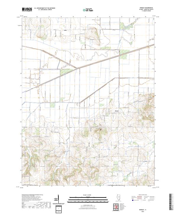
2024 Map of Bungay
USGS Topo · Published 2024About this map
Aden and Bungay anchor this contemporary survey of Hamilton County, Illinois, where the landscape is defined by a dense network of county roads and meandering drainage systems. The terrain is notably dissected by watercourses like Haw Creek, Big Creek, and Wolf Creek, which flow through the predominantly agricultural sections of the quadrangle. A significant local landmark for genealogists and researchers is Springer Cem, situated south of Bungay and east of Wolf Creek Drain. The map’s road network, including thoroughfares such as Aden Rd and Blairsville Rd, illustrates the persistent grid-based settlement pattern of Southern Illinois. Small-scale topographical changes are visible around the creek valleys, particularly where Raders Branch and Beaver Creek intersect the lower elevations, providing a clear view of the modern hydrological and transportation infrastructure of this rural corridor.
Find a feature on this map
56 named features on this map. Tap any name to fly to it.
Don’t see what you’re looking for? This feature index may not catch every label — zoom into the map to look around manually.
Map Details
Editions of this 2024 Bungay Map
This is the sole edition of this map. No revisions or reprints were ever made.
Other maps of this area

1941 · Enfield
USGS Topo · 1:62,500

1942 · McLeansboro
USGS Topo · 1:62,500

1944 · Enfield
USGS Topo · 1:62,500

1945 · McLeansboro
USGS Topo · 1:62,500

1947 · Wayne City
USGS Topo · 1:62,500

1948 · Fairfield
USGS Topo · 1:62,500

1958 · Belleville
USGS Topo · 1:250,000

1962 · Belleville
USGS Topo · 1:250,000
1971 · Boyleston
USGS Topo · 1:24,000
1971 · Burnt Prairie
USGS Topo · 1:24,000