
1956 Map of Bunnlevel
USGS Topo · Published 1958About this map
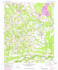
The confluence of the Upper Little River and Lower Little River dominates this mid-century landscape in Harnett and Cumberland counties. The rural character of the area is defined by a high concentration of country churches and family-named landmarks, such as Stewarts Ridge and Killens Hill. The community of Bunnlevel serves as a central hub, situated along the Norfolk Southern railroad line which cuts through the eastern portion of the terrain.
Find a feature on this map
59 named features on this map. Tap any name to fly to it.
Don’t see what you’re looking for? This feature index may not catch every label — zoom into the map to look around manually.
Map Details
Editions of this 1956 Bunnlevel Map
2 editions found
Other maps of this area

1948 · Fayetteville
USGS Topo · 1:62,500

1948 · Slocomb
USGS Topo · 1:24,000

1950 · Manchester
USGS Topo · 1:24,000

1950 · Slocomb
USGS Topo · 1:24,000

1953 · Raleigh
USGS Topo · 1:250,000

1954 · Raleigh
USGS Topo · 1:250,000

1956 · Anderson Creek
USGS Topo · 1:24,000
1957 · Manchester
USGS Topo · 1:24,000

1957 · Fayetteville
USGS Topo · 1:62,500

1973 · Erwin
USGS Topo · 1:24,000