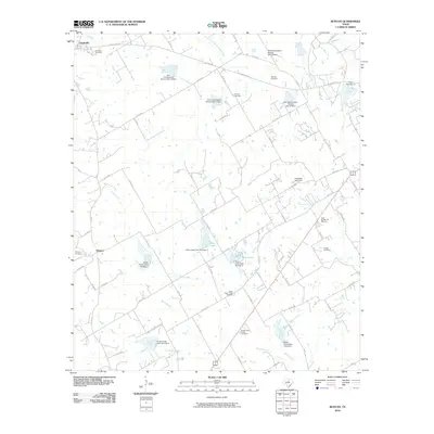
2010 Map of Bunyan
USGS Topo · Published 2010About this map
The agrarian landscape of western Erath County is defined by the headwaters of the South Fork North Bosque River and the winding course of Green Creek. This rural Texas region, centered on the community of Bunyan and the edges of Lingleville, is dotted with numerous small-scale water management projects, including Kiker Lake and several Soil Conservation Service dams. These features reflect a 20th-century focus on watershed management and soil preservation in the Texas Cross Timbers area.
Find a feature on this map
76 named features on this map. Tap any name to fly to it.
Don’t see what you’re looking for? This feature index may not catch every label — zoom into the map to look around manually.
Map Details
Editions of this 2010 Bunyan Map
This is the sole edition of this map. No revisions or reprints were ever made.
Other maps of this area

1890 · Stephenville
USGS Topo · 1:125,000

1920 · Stephenville
USGS Topo · 1:125,000

1954 · Abilene
USGS Topo · 1:250,000

1958 · Abilene
USGS Topo · 1:250,000
1961 · Alexander
USGS Topo · 1:24,000

1961 · Knob Hill
USGS Topo · 1:24,000

1961 · Stephenville
USGS Topo · 1:24,000

1965 · Huckabay SW
USGS Topo · 1:24,000

1965 · Lingleville
USGS Topo · 1:24,000
1965 · Dublin
USGS Topo · 1:24,000