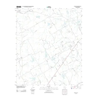
2012 Map of Bunyan
USGS Topo · Published 2012About this map
Lingleville and the small settlement of Bunyan anchor this rural Erath County landscape, which is defined by a dense network of country roads and agricultural water features. Numerous family and community burial grounds, including the Corinth Cem, Ramsey Cem, and Hickey Cem, are scattered across the terrain, reflecting the deep-rooted genealogical history of the area. The hydrology is dominated by the S Fork N Bosque River in the north and various branches like Goose Br, Buck Br, and Alarm Cr that feed into local impoundments such as Huckabee Lake and Bates Lake. This 2012 survey illustrates the persistence of small-scale Texas farming and ranching communities, with the infrastructure of FM 219 and Old Stephenville RD connecting isolated homesteads to the regional centers.
Find a feature on this map
80 named features on this map. Tap any name to fly to it.
Don’t see what you’re looking for? This feature index may not catch every label — zoom into the map to look around manually.
Map Details
Editions of this 2012 Bunyan Map
This is the sole edition of this map. No revisions or reprints were ever made.
Other maps of this area

1890 · Stephenville
USGS Topo · 1:125,000

1920 · Stephenville
USGS Topo · 1:125,000

1954 · Abilene
USGS Topo · 1:250,000

1958 · Abilene
USGS Topo · 1:250,000
1961 · Alexander
USGS Topo · 1:24,000

1961 · Knob Hill
USGS Topo · 1:24,000

1961 · Stephenville
USGS Topo · 1:24,000

1965 · Huckabay SW
USGS Topo · 1:24,000

1965 · Lingleville
USGS Topo · 1:24,000
1965 · Dublin
USGS Topo · 1:24,000