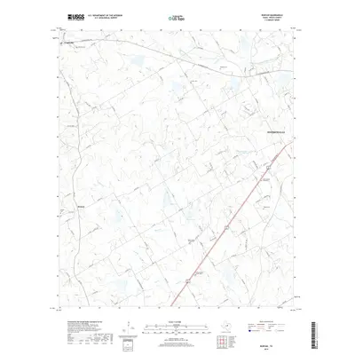
2019 Map of Bunyan
USGS Topo · Published 2019About this map
Stephenville occupies the eastern edge of this landscape, where the urban street grid transitions into the sprawling ranch and farm lands of Erath County. This 2019 survey documents a region defined by a dense network of country roads and numerous small burial grounds, reflecting a long-established rural community structure. Key settlements like Lingleville and Bunyan are surrounded by significant family and community landmarks, including Ramsey Cem, Corinth Cem, and Hickey Cem. The drainage pattern is led by the S Fork N Bosque River and several small creeks like Goose Br and Green Cr. One can observe the local topography through named features like Horseshoe Bend and the presence of localized water bodies such as Kiker Lake and Bates Lake, which dot the terrain between the county roads.
Find a feature on this map
98 named features on this map. Tap any name to fly to it.
Don’t see what you’re looking for? This feature index may not catch every label — zoom into the map to look around manually.
Map Details
Editions of this 2019 Bunyan Map
This is the sole edition of this map. No revisions or reprints were ever made.
Other maps of this area

1890 · Stephenville
USGS Topo · 1:125,000

1920 · Stephenville
USGS Topo · 1:125,000

1954 · Abilene
USGS Topo · 1:250,000

1958 · Abilene
USGS Topo · 1:250,000
1961 · Alexander
USGS Topo · 1:24,000

1961 · Knob Hill
USGS Topo · 1:24,000

1961 · Stephenville
USGS Topo · 1:24,000

1965 · Huckabay SW
USGS Topo · 1:24,000

1965 · Lingleville
USGS Topo · 1:24,000
1965 · Dublin
USGS Topo · 1:24,000