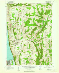
1950 Map of Burdett
USGS Topo · Published 1962About this map
Seneca Lake defines the western edge of this mid-century survey, where the deep glacial waters meet a landscape carved by steep ravines and waterfalls. The topography reveals a dramatic descent from Satterly Hill and Burnt Hill down toward the shoreline, marked by the iconic Hector Falls and the secluded Excelsior Glen. This area was a vital transit corridor, shown here with the Lehigh Valley railroad line winding along the slopes above the village of Burdett.
Find a feature on this map
46 named features on this map. Tap any name to fly to it.
Don’t see what you’re looking for? This feature index may not catch every label — zoom into the map to look around manually.
Map Details
Editions of this 1950 Burdett Map
4 editions found
Other maps of this area

1893 · Ithaca
USGS Topo · 1:62,500

1895 · Ithaca
USGS Topo · 1:62,500

1898 · Watkins Glen
USGS Topo · 1:62,500

1901 · Watkins
USGS Topo · 1:62,500

1902 · Genoa
USGS Topo · 1:62,500

1902 · Ovid
USGS Topo · 1:62,500

1905 · Watkins Glen
USGS Topo · 1:125,000

1942 · Dundee
USGS Topo · 1:24,000

1942 · Lodi
USGS Topo · 1:24,000

1942 · Trumansburg
USGS Topo · 1:24,000