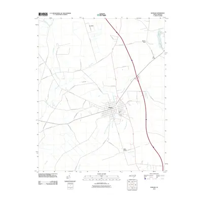
2010 Map of Burgaw
USGS Topo · Published 2010About this map
Burgaw serves as the central hub of this 2010 Pender County survey, showing the grid-patterned streets and the Burgaw Post Office as they appeared just after the first decade of the millennium. The town is situated within a dense network of watercourses, including the Osgood Branch, which flows through the center of the settlement. To the south, Saint Helena appears as a distinct community along the highway and rail corridors that define the north-south axis of this region.
Find a feature on this map
54 named features on this map. Tap any name to fly to it.
Don’t see what you’re looking for? This feature index may not catch every label — zoom into the map to look around manually.
Map Details
Editions of this 2010 Burgaw Map
This is the sole edition of this map. No revisions or reprints were ever made.
Other maps of this area

1942 · Burgaw
USGS Topo · 1:62,500

1947 · Rocky Point
USGS Topo · 1:62,500

1953 · Florence
USGS Topo · 1:250,000

1953 · Beaufort
USGS Topo · 1:250,000

1954 · Florence
USGS Topo · 1:250,000

1954 · Beaufort
USGS Topo · 1:250,000

1954 · Acme
USGS Topo · 1:62,500

1955 · Atkinson
USGS Topo · 1:62,500
1970 · Mooretown
USGS Topo · 1:24,000
1970 · Rocky Point
USGS Topo · 1:24,000