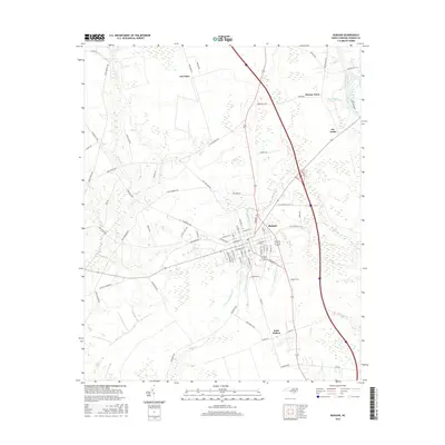
2016 Map of Burgaw
USGS Topo · Published 2016About this map
The Pender County seat of Burgaw serves as the central hub of this coastal plain landscape, where a dense network of local roads and waterways converge. The town's grid is bounded by the winding course of Burgaw Cr and the multiple branches of the Osgood Br system, including both the E Prong of Osgood Br and W Prong of Osgood Br. To the south, the community of Saint Helena sits along the upper reaches of Cypress Cr, while the eastern edge of the map is defined by the meandering Northeast Cape Fear River and its tributary, Watermelon Run. The area's agricultural and rural character is evidenced by small settlements like Van Eden, Murray Town, and Six Forks, which are linked by historic routes such as Penderlea Hwy and Old Savannah Rd.
Find a feature on this map
79 named features on this map. Tap any name to fly to it.
Don’t see what you’re looking for? This feature index may not catch every label — zoom into the map to look around manually.
Map Details
Editions of this 2016 Burgaw Map
This is the sole edition of this map. No revisions or reprints were ever made.
Other maps of this area

1942 · Burgaw
USGS Topo · 1:62,500

1947 · Rocky Point
USGS Topo · 1:62,500

1953 · Florence
USGS Topo · 1:250,000

1953 · Beaufort
USGS Topo · 1:250,000

1954 · Florence
USGS Topo · 1:250,000

1954 · Beaufort
USGS Topo · 1:250,000

1954 · Acme
USGS Topo · 1:62,500

1955 · Atkinson
USGS Topo · 1:62,500
1970 · Mooretown
USGS Topo · 1:24,000
1970 · Rocky Point
USGS Topo · 1:24,000