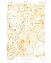
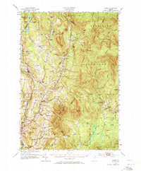
1951 Map of Burke
USGS Topo · Published 1956About this map
Burke Mountain stands as a prominent landmark in this 1951 survey of northeastern Vermont, where the Passumpsic River and its East Branch carve through the granite-ridged terrain of the East Haven Range. The landscape is defined by small, clustered settlements like East Burke and West Burke, alongside several schools that served these rural communities, including the Packer Sch and Marshall Sch. The geography reflects a mid-century period when the local economy was deeply tied to the land and the transit corridors of the Canadian Pacific and the St Johnsbury and Lake Champlain railroads.
Find a feature on this map
100 named features on this map. Tap any name to fly to it.
Don’t see what you’re looking for? This feature index may not catch every label — zoom into the map to look around manually.
Map Details
Editions of this 1951 Burke Map
6 editions found

Other maps of this area

1900 · Whitefield
USGS Topo · 1:62,500

1919 · Lake Memphremagog
USGS Topo · 1:62,500

1920 · Derby
USGS Topo · 1:62,500

1920 · Guildhall
USGS Topo · 1:62,500

1923 · Lake Memphremagog
USGS Topo · 1:48,000

1924 · Island Pond
USGS Topo · 1:48,000

1925 · Memphremagog
USGS Topo · 1:62,500

1926 · Island Pond
USGS Topo · 1:62,500

1929 · Averill
USGS Topo · 1:62,500

1931 · Guildhall
USGS Topo · 1:48,000