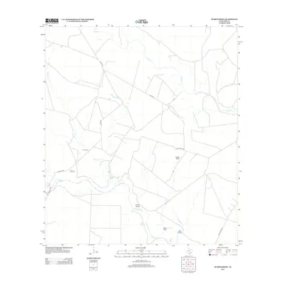
2013 Map of Burkes Ridge
USGS Topo · Published 2013About this map
The Aransas River winds through this South Texas landscape, creating a distinct riparian corridor defined by drainage features like Panther Hollow and Moss Gully. This 2013 survey of Bee County captures a rural environment where land use is marked by large ranching tracts and private access roads. Local history and folklore are embedded in the terrain at The Devil Tree and the Campo Santo Cem near Guajolote Rd. The network of waterways, including Medio Cr and Spring Cr, dictates the placement of crossings such as Corrigan Hole. This map provides a detailed view of the regional topography, from the namesake Burkes Ridge to the lower reaches of Burk Hollow, reflecting the traditional land divisions of the Texas Coastal Bend.
Find a feature on this map
16 named features on this map. Tap any name to fly to it.
Don’t see what you’re looking for? This feature index may not catch every label — zoom into the map to look around manually.
Map Details
Editions of this 2013 Burkes Ridge Map
This is the sole edition of this map. No revisions or reprints were ever made.
Other maps of this area

1953 · Beeville
USGS Topo · 1:250,000

1954 · Skidmore
USGS Topo · 1:62,500

1954 · Woodsboro
USGS Topo · 1:62,500

1954 · Sinton
USGS Topo · 1:62,500

1954 · Refugio
USGS Topo · 1:62,500

1956 · Beeville
USGS Topo · 1:250,000

1960 · Beeville
USGS Topo · 1:250,000

1978 · Cranell
USGS Topo · 1:24,000

1978 · Refugio SW
USGS Topo · 1:24,000

1979 · Burkes Ridge
USGS Topo · 1:24,000