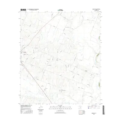
2016 Map of Burleigh
USGS Topo · Published 2016About this map
The Brazos River forms a winding eastern boundary for this portion of Austin County, where rural life is defined by small settlements and numerous family-named landmarks. The eastern edge of Bellville appears along the western margin, with Grawunder Field and Oak Knoll Cem marking the transition from town to countryside. The area is dotted with historic burial sites that speak to the region's genealogical depth, including the Pilgrims Rest Cem, Menke Cem, and Coshatte Cem.
Find a feature on this map
73 named features on this map. Tap any name to fly to it.
Don’t see what you’re looking for? This feature index may not catch every label — zoom into the map to look around manually.
Map Details
Editions of this 2016 Burleigh Map
This is the sole edition of this map. No revisions or reprints were ever made.
Other maps of this area

1930 · Brenham
USGS Topo · 1:62,500

1953 · Seguin
USGS Topo · 1:250,000

1954 · Austin
USGS Topo · 1:250,000

1956 · Bellville
USGS Topo · 1:62,500

1956 · Sealy
USGS Topo · 1:62,500

1956 · Hempstead
USGS Topo · 1:62,500

1956 · Brenham
USGS Topo · 1:62,500

1958 · Seguin
USGS Topo · 1:250,000

1960 · San Felipe
USGS Topo · 1:24,000
1960 · Sealy
USGS Topo · 1:24,000