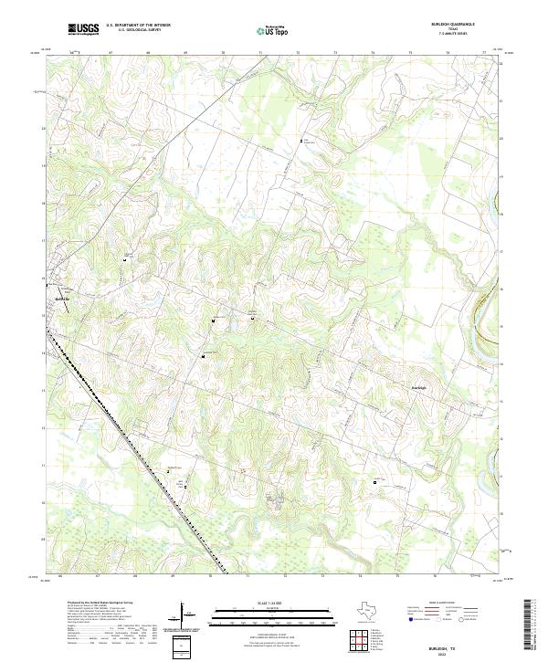
2022 Map of Burleigh
USGS Topo · Published 2022About this map
The rolling plains of Austin and Waller counties come into focus in this contemporary survey, where the eastern boundary is defined by the winding course of the Brazos River. Centered on the settlement of Burleigh, the landscape is a network of rural routes like FM 529 Rd and Coshatte Rd, connecting family farmsteads and agricultural hubs. To the west, the town of Bellville appears at the map's edge, anchored by Grawunder Field. A high density of burial sites suggests deep generational roots in the region, with Ives Creek Cem, Abel Family Cem, and Pilgrims Rest Cem serving as quiet markers of the area's early Texas pioneers. The terrain is deeply etched by a complex drainage system including Piney Cr, Mill Creek, and Clear Cr, which dictate the placement of roads and homesteads across the prairie.
Find a feature on this map
70 named features on this map. Tap any name to fly to it.
Don’t see what you’re looking for? This feature index may not catch every label — zoom into the map to look around manually.
Map Details
Editions of this 2022 Burleigh Map
This is the sole edition of this map. No revisions or reprints were ever made.
Other maps of this area

1930 · Brenham
USGS Topo · 1:62,500

1953 · Seguin
USGS Topo · 1:250,000

1954 · Austin
USGS Topo · 1:250,000

1956 · Bellville
USGS Topo · 1:62,500

1956 · Sealy
USGS Topo · 1:62,500

1956 · Hempstead
USGS Topo · 1:62,500

1956 · Brenham
USGS Topo · 1:62,500

1958 · Seguin
USGS Topo · 1:250,000

1960 · San Felipe
USGS Topo · 1:24,000
1960 · Sealy
USGS Topo · 1:24,000