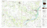
1985 Map of Burlington
USGS Topo · Published 1985About this map
The Mississippi River and the Des Moines River define the Tri-State region captured in this mid-1980s survey, where Iowa, Illinois, and Missouri meet. Burlington, the principal urban hub, sits atop the Flint Hills, overlooking a complex network of islands and sloughs such as Peel Island and O'Connell Island. West of the city, the sprawling Iowa Army Ammunition Plant occupies a significant footprint between Middletown and the Skunk River. The landscape is a mix of intensive agriculture and managed conservation, anchored by Shimek State Forest and several riverfront state parks.
Find a feature on this map
225 named features on this map. Tap any name to fly to it.
Don’t see what you’re looking for? This feature index may not catch every label — zoom into the map to look around manually.
Map Details
Editions of this 1985 Burlington Map
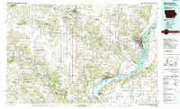
2 editions found
Other maps of this area

1903 · Kahoka
USGS Topo · 1:125,000

1903 · Edina
USGS Topo · 1:125,000

1913 · Colchester
USGS Topo · 1:62,500

1918 · La Harpe
USGS Topo · 1:62,500

1932 · Lomax
USGS Topo · 1:62,500

1933 · Carthage
USGS Topo · 1:62,500

1934 · Oquawka
USGS Topo · 1:48,000

1934 · Burlington
USGS Topo · 1:48,000

1935 · Keithsburg
USGS Topo · 1:48,000

1936 · Keokuk
USGS Topo · 1:62,500