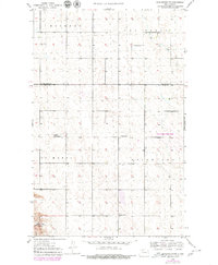
1949 Map of Burlington NW
USGS Topo · Published 1980About this map
Minot Air Force Base occupies a significant portion of the eastern landscape in this mid-century survey, which documents a transition period for the Ward and Renville county line. While the military presence is a dominant modern landmark, the map also captures an older rural infrastructure represented by a series of numbering schoolhouses, such as Stamen School No 2 and School No 4. The terrain is characterized by the expansive glacial drift plains of North Dakota, with Egg Creek meandering through the township of Van Buren. To the southwest, the Upper Souris National Wildlife Refuge borders the region, providing a contrast between the preserved natural river valley and the gridded agricultural townships of Muskego, St Marys, and Waterford.
Find a feature on this map
12 named features on this map. Tap any name to fly to it.
Don’t see what you’re looking for? This feature index may not catch every label — zoom into the map to look around manually.
Map Details
Editions of this 1949 Burlington NW Map
3 editions found
Other maps of this area

1948 · Burlington
USGS Topo · 1:24,000

1948 · Lansford
USGS Topo · 1:62,500

1948 · Burlington
USGS Topo · 1:62,500

1948 · Lansford SW
USGS Topo · 1:24,000

1949 · Burlington NW
USGS Topo · 1:24,000

1949 · Lansford SW
USGS Topo · 1:24,000

1949 · Carpio NE
USGS Topo · 1:24,000

1949 · Grano
USGS Topo · 1:24,000

1949 · Lansford SE
USGS Topo · 1:24,000

1949 · Burlington SE
USGS Topo · 1:24,000