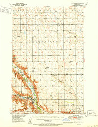
1951 Map of Burlington
USGS Topo · Published 1951About this map
The Souris River and Des Lacs River converge in the southwest corner of this Ward County landscape, creating a distinctive corridor for transport and settlement in the mid-20th century. Following the river's path, the Minneapolis ST Paul And Sault Ste Marie Railway connects the town of Burlington to the regional hub of Minot. The uplands are defined by a grid of agricultural townships like Waterford and Kirklie, dotted with rural educational and religious centers such as Graham Sch and Lynch Ch. North of the river, the landscape transitions into a flatter terrain marked by Livingston Lake and the Nat Wildlife Refuge. This survey documents a prairie economy tied to the rails, featuring the Port O'Minot Airport and small crossroads like Ruthville and Livingston.
Find a feature on this map
38 named features on this map. Tap any name to fly to it.
Don’t see what you’re looking for? This feature index may not catch every label — zoom into the map to look around manually.
Map Details
Editions of this 1951 Burlington Map
This is the sole edition of this map. No revisions or reprints were ever made.
Other maps of this area

1928 · Minot
USGS Topo · 1:62,500

1929 · Sawyer
USGS Topo · 1:62,500

1948 · Burlington
USGS Topo · 1:24,000

1948 · Lansford
USGS Topo · 1:62,500

1948 · Burlington
USGS Topo · 1:62,500

1948 · Minot NW
USGS Topo · 1:24,000

1948 · Lansford SW
USGS Topo · 1:24,000

1948 · Surrey
USGS Topo · 1:24,000

1949 · Burlington NW
USGS Topo · 1:24,000

1949 · Glenburn
USGS Topo · 1:24,000