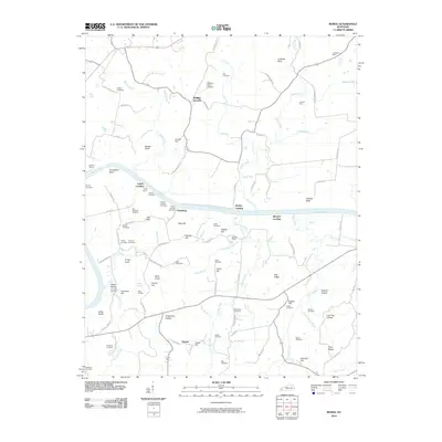
2010 Map of Burna
USGS Topo · Published 2010About this map
The Cumberland River and Tennessee River converge in this corner of Livingston County, shaping a landscape defined by river landings and hilltop cemeteries. Riverside life is anchored by historic points of transit like Lemen Landing, Moxley Landing, and Mitchell Landing, which served the local farming and mining interests of the region. Inland, the terrain is marked by numerous family burial grounds such as the Phillips Cemetery, Peck Cemetery, and the Deason Cochran Cemetery, providing a dense record of the area's genealogical history.
Find a feature on this map
109 named features on this map. Tap any name to fly to it.
Don’t see what you’re looking for? This feature index may not catch every label — zoom into the map to look around manually.
Map Details
Editions of this 2010 Burna Map
This is the sole edition of this map. No revisions or reprints were ever made.
Other maps of this area

1916 · Fords Ferry
USGS Topo · 1:62,500

1916 · Golconda
USGS Topo · 1:62,500

1920 · Goloonda
USGS Topo · 1:48,000

1921 · Fords Ferry
USGS Topo · 1:48,000

1921 · Golconda
USGS Topo · 1:62,500

1925 · Cave In Rock
USGS Topo · 1:62,500

1928 · Eddyville
USGS Topo · 1:48,000

1929 · Smithland
USGS Topo · 1:62,500

1931 · Eddyville
USGS Topo · 1:62,500

1936 · Eddyville
USGS Topo · 1:48,000