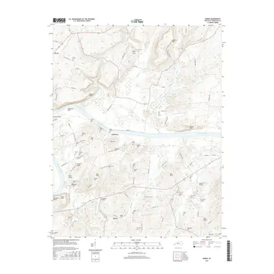
2016 Map of Burna
USGS Topo · Published 2016About this map
The Cumberland River carves a sweeping arc through the center of this Livingston County landscape, defining the topography of Horseshoe Bend and the steep riverfront at Red House Bluffs. Near the river's northern bank, the small settlement of Vicksburg sits at a crossroads of rural routes like Head Rd and Lemon Landing Rd, serving as a focal point for a region deeply marked by its family heritage. Numerous burial grounds, such as the Deason Cochran Cem, Lemen Cem, and Green-Johnson Cem, are clustered near the water, while the community of Burna anchors the northwestern corner of the quadrangle. Inland, the terrain rises into prominent high points like Bald Knob and Oak Ridge, interspersed with hollows such as Grassham Hollow and Polecat Hollow. This rural landscape is further characterized by small-scale aviation at the Barnes Farm Airport and several historic family plots including the Phillips Cem and Lee-Goldwell Cem.
Find a feature on this map
108 named features on this map. Tap any name to fly to it.
Don’t see what you’re looking for? This feature index may not catch every label — zoom into the map to look around manually.
Map Details
Editions of this 2016 Burna Map
This is the sole edition of this map. No revisions or reprints were ever made.
Other maps of this area

1916 · Fords Ferry
USGS Topo · 1:62,500

1916 · Golconda
USGS Topo · 1:62,500

1920 · Goloonda
USGS Topo · 1:48,000

1921 · Fords Ferry
USGS Topo · 1:48,000

1921 · Golconda
USGS Topo · 1:62,500

1925 · Cave In Rock
USGS Topo · 1:62,500

1928 · Eddyville
USGS Topo · 1:48,000

1929 · Smithland
USGS Topo · 1:62,500

1931 · Eddyville
USGS Topo · 1:62,500

1936 · Eddyville
USGS Topo · 1:48,000