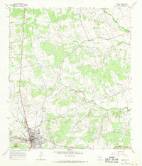
1967 Map of Burnet
USGS Topo · Published 1970About this map
Burnet serves as the focal point of this late 1960s survey, situated where the Southern Pacific tracks met a landscape defined by ranching and small-scale gravel extraction. The map reveals the historical depth of the area through the Fort Croghan Historical Site and several local burial grounds like Pebble Mound Cem and Pleasant Hill Cem. The town's infrastructure at this time included the Allen Hospital, a dedicated Athletic Field, and the Radio Towers (KCYL).
Find a feature on this map
28 named features on this map. Tap any name to fly to it.
Don’t see what you’re looking for? This feature index may not catch every label — zoom into the map to look around manually.
Map Details
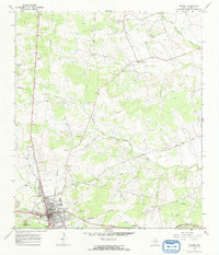
Editions of this 1967 Burnet Map
2 editions found
Other maps of this area

1887 · Burnet
USGS Topo · 1:125,000

1893 · Burnet
USGS Topo · 1:125,000

1903 · Burnet
USGS Topo · 1:125,000

1909 · Burnet
USGS Topo · 1:125,000

1929 · Marble Falls
USGS Topo · 1:62,500

1932 · Tow
USGS Topo · 1:62,500

1932 · Marble Falls
USGS Topo · 1:62,500

1932 · Bertram
USGS Topo · 1:62,500

1954 · Llano
USGS Topo · 1:250,000

1955 · Llano
USGS Topo · 1:250,000