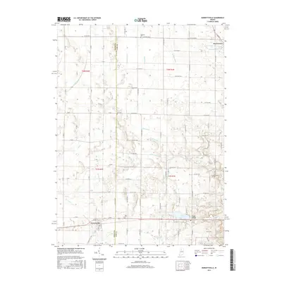
2016 Map of Burnettsville
USGS Topo · Published 2016About this map
Royal Center and Burnettsville anchor this 2016 survey along the boundary of White and Cass Counties. The landscape is defined by an intricate network of drainage systems, including Fredricks Ditch, Stubhar Ditch, and Galbreath Ditch, which channel water toward natural features like Crooked Cr and the glacial Lake Cicott. The rectilinear grid of county roads provides a structured framework for the scattered agricultural homesteads and local landmarks that have persisted for generations.
Find a feature on this map
54 named features on this map. Tap any name to fly to it.
Don’t see what you’re looking for? This feature index may not catch every label — zoom into the map to look around manually.
Map Details
Editions of this 2016 Burnettsville Map
This is the sole edition of this map. No revisions or reprints were ever made.
Other maps of this area

1953 · Danville
USGS Topo · 1:250,000

1955 · Danville
USGS Topo · 1:250,000

1956 · Danville
USGS Topo · 1:250,000

1960 · Lucerne
USGS Topo · 1:24,000

1960 · Grass Creek
USGS Topo · 1:24,000

1962 · Buffalo
USGS Topo · 1:24,000

1962 · Burrows
USGS Topo · 1:24,000

1962 · Star City
USGS Topo · 1:24,000

1962 · Burnettsville
USGS Topo · 1:24,000
1962 · Clymers
USGS Topo · 1:24,000