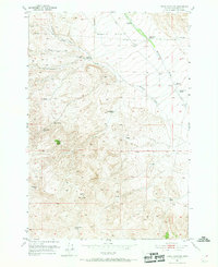
1952 Map of Burns Mountain
USGS Topo · Published 1969About this map
Argenta Flats dominates the northern landscape of this Beaverhead County region, where the high-altitude terrain transitions from broad plains into the prominent elevations of Burns Mountain and Timber Butte. This 1952 survey documents a ranching economy defined by isolated family holdings and vital water sources. Strategic waypoints such as Tenmile House and various Windmill sites are scattered across the landscape, connected by a network of unimproved roads and a prominent Telephone Line. The importance of water management in this arid environment is evident through the placement of Dillon Reservoir and numerous named springs, including Albers Springs and School Section Spring. The mapping of family-named properties like the John Shaffner Ranch and Christensen Ranch provides a specific look at mid-century land use in Southwest Montana, while the deeply etched path of Ermont Gulch illustrates the area's natural drainage patterns leading toward Rattlesnake Creek.
Find a feature on this map
25 named features on this map. Tap any name to fly to it.
Don’t see what you’re looking for? This feature index may not catch every label — zoom into the map to look around manually.
Map Details
Editions of this 1952 Burns Mountain Map
4 editions found
Other maps of this area

1893 · Dillon
USGS Topo · 1:250,000

1952 · Argenta
USGS Topo · 1:24,000

1952 · Bannack
USGS Topo · 1:24,000

1952 · Burns Mountain
USGS Topo · 1:24,000

1952 · Eli Spring
USGS Topo · 1:24,000

1952 · Dalys
USGS Topo · 1:24,000

1952 · Gallagher Mountain
USGS Topo · 1:24,000

1952 · Ermont
USGS Topo · 1:24,000

1955 · Dillon
USGS Topo · 1:250,000

1957 · Dillon
USGS Topo · 1:250,000