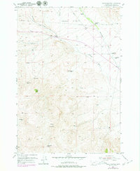
1952 Map of Burns Mountain
USGS Topo · Published 1979About this map
Argenta Flats and the high peaks of Burns Mountain dominate this mid-century survey of Beaverhead County, revealing a landscape defined by ranching and resource extraction. The map documents several established family holdings, including the Christensen Ranch and the John Shaffner Ranch, while the presence of the Tenmile House indicates long-standing travel corridors through the region. Water management is critical in this high-altitude terrain, illustrated by the Dillon Reservoir and a network of essential water sources like School Section Spring and Magpie Spring. The topography transitions from the open flats into the steep rises of Timber Butte, carved by drainages such as Ermont Gulch and Rattlesnake Creek. This edition, updated in the late 1970s, preserves the mid-century layout of jeep trails and telephone lines that supported the local ranching economy.
Find a feature on this map
21 named features on this map. Tap any name to fly to it.
Don’t see what you’re looking for? This feature index may not catch every label — zoom into the map to look around manually.
Map Details
Editions of this 1952 Burns Mountain Map
4 editions found
Other maps of this area

1893 · Dillon
USGS Topo · 1:250,000

1952 · Argenta
USGS Topo · 1:24,000

1952 · Bannack
USGS Topo · 1:24,000

1952 · Burns Mountain
USGS Topo · 1:24,000

1952 · Eli Spring
USGS Topo · 1:24,000

1952 · Dalys
USGS Topo · 1:24,000

1952 · Gallagher Mountain
USGS Topo · 1:24,000

1952 · Ermont
USGS Topo · 1:24,000

1955 · Dillon
USGS Topo · 1:250,000

1957 · Dillon
USGS Topo · 1:250,000