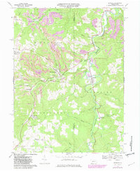
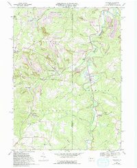
1968 Map of Burnside
USGS Topo · Published 1968About this map
The West Branch Susquehanna River snakes through the central corridor of this survey, defining the industrial and social landscape of the Burnside area. During the late 1960s, the region was characterized by a heavy concentration of extractive industry, evidenced by the numerous Strip Mines and the Conrail rail lines that navigate the narrow valleys. Settlements like Glen Campbell and Arcadia are tucked into the drainages of Cush Creek and Horton Run, while higher ground features community landmarks like the Lookout Tower near Urey. Local genealogy is well-represented through numerous burial grounds, including Sunderland Cem and Bennett Cem, alongside neighborhood parish centers such as St Michaels Church and SS Peter and Paul Church. The map also captures the sprawling State Game Lands No 174, illustrating the balance between wilderness and the region's active mining operations.
Find a feature on this map
49 named features on this map. Tap any name to fly to it.
Don’t see what you’re looking for? This feature index may not catch every label — zoom into the map to look around manually.
Map Details
Editions of this 1968 Burnside Map
5 editions found
Other maps of this area

1902 · Patton
USGS Topo · 1:62,500

1902 · Barnesboro
USGS Topo · 1:62,500

1903 · Curwensville
USGS Topo · 1:62,500

1904 · Barnesboro
USGS Topo · 1:62,500

1904 · Patton
USGS Topo · 1:62,500

1906 · Punxsutawney
USGS Topo · 1:62,500

1939 · Curwensville
USGS Topo · 1:62,500

1939 · Punxsutawney
USGS Topo · 1:62,500

1942 · Curwensville
USGS Topo · 1:62,500

1942 · Punxsutawney
USGS Topo · 1:62,500