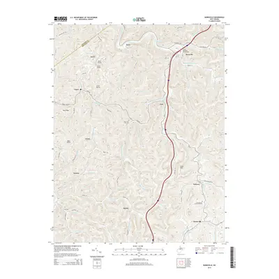
2014 Map of Burnsville
USGS Topo · Published 2014About this map
The Little Kanawha River winds through this central West Virginia landscape, serving as a primary geographic axis for the settlements of Burnsville, Gem, and Rollyson. This 2014 edition reveals the complex drainage network of the region, where numerous runs and forks such as Duskcamp Run and Saltlick Creek have carved deep hollows like Shock Hollow and Carter Hollow. The map provides significant genealogical value, documenting sites such as the Little Kanawha Memorial Gardens and the K of P Cem near the river's bend.
Find a feature on this map
84 named features on this map. Tap any name to fly to it.
Don’t see what you’re looking for? This feature index may not catch every label — zoom into the map to look around manually.
Map Details
Editions of this 2014 Burnsville Map
This is the sole edition of this map. No revisions or reprints were ever made.
Other maps of this area

1893 · Sutton
USGS Topo · 1:125,000

1906 · Glenville
USGS Topo · 1:62,500

1906 · Burnsville
USGS Topo · 1:62,500

1908 · Gassaway
USGS Topo · 1:48,000

1908 · Sutton
USGS Topo · 1:48,000

1910 · Sutton Special
USGS Topo · 1:62,500

1910 · Gassaway
USGS Topo · 1:62,500

1925 · Glenville
USGS Topo · 1:62,500

1925 · Burnsville
USGS Topo · 1:62,500

1927 · Burnsville
USGS Topo · 1:62,500