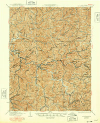
1927 Map of Burnsville
USGS Topo · Published 1948About this map
Little Kanawha River drainage systems define the rugged topography of central West Virginia in this early 20th-century survey. The landscape is intensely subdivided into small mountain hollows, each hosting essential community structures like the St Bernards School, Clover Fork School, and Old Field School. The town of Burnsville serves as a primary hub where the Baltimore and Ohio railroad meets the river, reflecting the region's historical reliance on both water and rail transport.
Find a feature on this map
138 named features on this map. Tap any name to fly to it.
Don’t see what you’re looking for? This feature index may not catch every label — zoom into the map to look around manually.
Map Details
Editions of this 1927 Burnsville Map
3 editions found

Other maps of this area

1893 · Buckhannon
USGS Topo · 1:125,000

1893 · Sutton
USGS Topo · 1:125,000

1896 · Buckhannon
USGS Topo · 1:125,000

1897 · Buckhannon
USGS Topo · 1:125,000

1904 · Weston
USGS Topo · 1:62,500

1904 · Vadis
USGS Topo · 1:62,500

1906 · Holbrook
USGS Topo · 1:62,500

1906 · Glenville
USGS Topo · 1:62,500

1906 · Burnsville
USGS Topo · 1:62,500

1908 · Gassaway
USGS Topo · 1:48,000