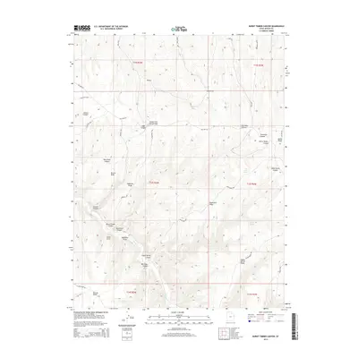
2014 Map of Burnt Timber Canyon
USGS Topo · Published 2014About this map
Bitter Cr carves through this high desert terrain in Uintah County, creating a complex drainage network defined by prominent landforms like McCook Ridge and Rector Ridge. The area is marked by a series of deep canyons and seasonal water sources, including Indian Spring and Flat Rock Spring, which historically supported movement through this arid environment. A network of high-elevation roads such as Wolf Den Rd and Big Park Rd trace the spines of the ridges, connecting points of interest like Smith Point and Dynamite Point. The landscape's character is shaped by deep incisions like Burnt Timber Canyon and Nelson Canyon, illustrating the erosional patterns typical of the Uinta Basin's eastern margins.
Find a feature on this map
36 named features on this map. Tap any name to fly to it.
Don’t see what you’re looking for? This feature index may not catch every label — zoom into the map to look around manually.
Map Details
Editions of this 2014 Burnt Timber Canyon Map
This is the sole edition of this map. No revisions or reprints were ever made.
Other maps of this area

1885 · East Tavaputs
USGS Topo · 1:250,000

1956 · Grand Junction
USGS Topo · 1:250,000

1959 · Grand Junction
USGS Topo · 1:250,000

1960 · Grand Junction
USGS Topo · 1:250,000

1962 · Grand Junction
USGS Topo · 1:250,000

1964 · Grand Junction
USGS Topo · 1:250,000

1965 · Grand Junction
USGS Topo · 1:250,000

1966 · Seep Canyon
USGS Topo · 1:24,000

1966 · Tom Patterson Canyon
USGS Topo · 1:24,000
1966 · Rat Hole Ridge
USGS Topo · 1:24,000