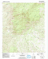
1992 Map of Burro Peak
USGS Topo · Published 1992About this map
The Big Burro Mountains and the Continental Divide define this high-elevation landscape within the Gila National Forest. This mapping from the early 1990s reveals an extensive history of resource extraction, with deep-set labels for the Silver Dollar Mine, Austin Amazon Mines, and the notably named Merry Widow Shaft. These workings are interspersed with traditional ranching outposts such as the McCauley Ranch and the Walking X Ranch, alongside the Burro Mountain Homestead. The terrain is deeply incised by numerous canyons, including Whitewater Canyon and Deadman Canyon, which collect at natural water sources like Mud Spring and Grapevine Spring. This document provides a look at the intersection of mining, forestry, and high-desert agriculture in Grant County.
Find a feature on this map
44 named features on this map. Tap any name to fly to it.
Don’t see what you’re looking for? This feature index may not catch every label — zoom into the map to look around manually.
Map Details
Editions of this 1992 Burro Peak Map
This is the sole edition of this map. No revisions or reprints were ever made.
Other maps of this area

1909 · Silver City
USGS Topo · 1:125,000

1950 · Tyrone
USGS Topo · 1:24,000

1950 · White Signal
USGS Topo · 1:24,000

1950 · Wind Mountain
USGS Topo · 1:24,000

1950 · Burro Peak
USGS Topo · 1:24,000

1951 · White Signal
USGS Topo · 1:24,000

1951 · Big Burro Mountains
USGS Topo · 1:24,000
1951 · Tyrone
USGS Topo · 1:24,000

1951 · Wind Mountain
USGS Topo · 1:24,000

1954 · Silver City
USGS Topo · 1:250,000