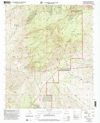
1999 Map of Burro Peak
USGS Topo · Published 2002About this map
The Big Burro Mountains define this section of the Gila National Forest, where the high-altitude Continental Divide winds past Ferguson Mountain and Burro Peak. This landscape is heavily marked by a legacy of extraction, showing a dense network of mining sites including the Austin-Amazon Mines, the Merry Widow Shaft, and the Silver Dollar Mine. These labels reveal the industrial intensity of the Grant County highlands, where even small-scale prospects and mine dumps are meticulously recorded.
Find a feature on this map
57 named features on this map. Tap any name to fly to it.
Don’t see what you’re looking for? This feature index may not catch every label — zoom into the map to look around manually.
Map Details
Editions of this 1999 Burro Peak Map
This is the sole edition of this map. No revisions or reprints were ever made.
Other maps of this area

1909 · Silver City
USGS Topo · 1:125,000

1950 · Tyrone
USGS Topo · 1:24,000

1950 · White Signal
USGS Topo · 1:24,000

1950 · Wind Mountain
USGS Topo · 1:24,000

1950 · Burro Peak
USGS Topo · 1:24,000

1951 · White Signal
USGS Topo · 1:24,000

1951 · Big Burro Mountains
USGS Topo · 1:24,000
1951 · Tyrone
USGS Topo · 1:24,000

1951 · Wind Mountain
USGS Topo · 1:24,000

1954 · Silver City
USGS Topo · 1:250,000