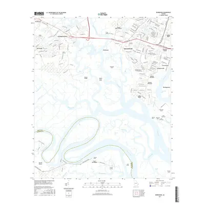
2017 Map of Burroughs
USGS Topo · Published 2017About this map
The Little Ogeechee River and Ogeechee River snake through this coastal landscape south of Savannah, defining an area of intricate marshlands and suburban expansion. Historically significant sites like Fort McAllister and Wild Horn Cem anchor the lower reaches of the map, while the northern sections show the developed neighborhoods of Georgetown and Windsor Forest.
Find a feature on this map
159 named features on this map. Tap any name to fly to it.
Don’t see what you’re looking for? This feature index may not catch every label — zoom into the map to look around manually.
Map Details
Editions of this 2017 Burroughs Map
This is the sole edition of this map. No revisions or reprints were ever made.
Other maps of this area

1920 · Meldrim
USGS Topo · 1:62,500

1920 · Limerick
USGS Topo · 1:62,500

1942 · Meldrim
USGS Topo · 1:62,500

1942 · Savannah
USGS Topo · 1:62,500

1944 · Limerick
USGS Topo · 1:62,500

1944 · Ossabaw Island
USGS Topo · 1:62,500

1945 · Ossabaw Island
USGS Topo · 1:62,500

1946 · Brunswick
USGS Topo · 1:250,000

1947 · Savannah
USGS Topo · 1:250,000

1948 · Brunswick
USGS Topo · 1:250,000