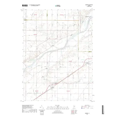
2019 Map of Burrows
USGS Topo · Published 2019About this map
Lockport and the surrounding river bottomlands are defined by the path of the Wabash and Erie Canal, which remains a visible element of the local landscape alongside the Wabash River. This modern survey details a region where traditional crossroads and small settlements like Rockfield and Burrows are connected by a grid of county roads and State Rd 25. The concentration of family and community burial grounds, such as Seceder Cem and the Independent Order of Odd Fellows Cem, provides a significant inventory for genealogical research.
Find a feature on this map
65 named features on this map. Tap any name to fly to it.
Don’t see what you’re looking for? This feature index may not catch every label — zoom into the map to look around manually.
Map Details
Editions of this 2019 Burrows Map
This is the sole edition of this map. No revisions or reprints were ever made.
Other maps of this area

1953 · Danville
USGS Topo · 1:250,000

1955 · Danville
USGS Topo · 1:250,000

1956 · Danville
USGS Topo · 1:250,000

1960 · Lucerne
USGS Topo · 1:24,000

1962 · Deer Creek
USGS Topo · 1:24,000

1962 · Flora
USGS Topo · 1:24,000

1962 · Burrows
USGS Topo · 1:24,000

1962 · Delphi
USGS Topo · 1:24,000

1962 · Burnettsville
USGS Topo · 1:24,000
1962 · Clymers
USGS Topo · 1:24,000