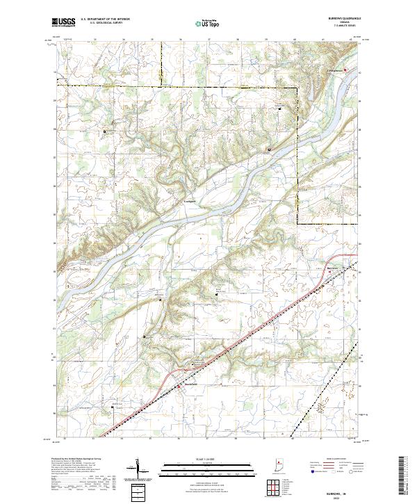
2022 Map of Burrows
USGS Topo · Published 2022About this map
Wabash River frontage and the historic path of the Wabash and Erie Canal define this portion of north-central Indiana. The landscape is dotted with small agricultural settlements and a high density of family and lodge burial grounds, providing significant resources for genealogical research. Communities such as Lockport, Burrows, and Rockfield serve as anchor points along the valley, while the river is joined by various tributaries including Rock Creek and Burnetts Cr. The map details the local road network crossing the White, Cass, and Carroll county lines. Of particular note for local historians is the Independent Order of Odd Fellows Cem near Rockfield, alongside numerous smaller sites like Parks Groninger Cem and Brown Church Cem, which preserve the names of early resident families in the region.
Find a feature on this map
65 named features on this map. Tap any name to fly to it.
Don’t see what you’re looking for? This feature index may not catch every label — zoom into the map to look around manually.
Map Details
Editions of this 2022 Burrows Map
This is the sole edition of this map. No revisions or reprints were ever made.
Other maps of this area

1953 · Danville
USGS Topo · 1:250,000

1955 · Danville
USGS Topo · 1:250,000

1956 · Danville
USGS Topo · 1:250,000

1960 · Lucerne
USGS Topo · 1:24,000

1962 · Deer Creek
USGS Topo · 1:24,000

1962 · Flora
USGS Topo · 1:24,000

1962 · Burrows
USGS Topo · 1:24,000

1962 · Delphi
USGS Topo · 1:24,000

1962 · Burnettsville
USGS Topo · 1:24,000
1962 · Clymers
USGS Topo · 1:24,000