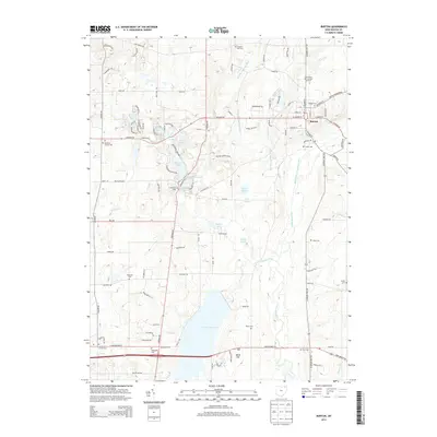
2013 Map of Burton
USGS Topo · Published 2013About this map
Punderson State Park anchors the center of this Geauga County landscape, a region defined by its dense network of kettle lakes and reservoirs. The village of Burton sits at the convergence of several historic roads, serving as a regional hub near the headwaters of the Cuyahoga River. The southern portion of the map is dominated by the expansive La Due Reservoir, which has significantly altered the drainage of Fire Run and surrounding tributaries.
Find a feature on this map
112 named features on this map. Tap any name to fly to it.
Don’t see what you’re looking for? This feature index may not catch every label — zoom into the map to look around manually.
Map Details
Editions of this 2013 Burton Map
This is the sole edition of this map. No revisions or reprints were ever made.
Other maps of this area

1904 · Chardon
USGS Topo · 1:62,500

1905 · Garrettsville
USGS Topo · 1:62,500

1905 · Mentor
USGS Topo · 1:62,500

1906 · Chardon
USGS Topo · 1:62,500

1906 · Chagrin Falls
USGS Topo · 1:62,500

1907 · Garrettsville
USGS Topo · 1:62,500

1907 · Mentor
USGS Topo · 1:62,500

1908 · Chagrin Falls
USGS Topo · 1:62,500

1950 · Cleveland
USGS Topo · 1:250,000

1953 · Chardon
USGS Topo · 1:24,000